
Key Takeaways
- Good development starts with a clear picture of land boundaries, slopes, soils, water, vegetation, and nearby infrastructure.
- Early field verification can expose constraints that aerial images, tax records, and older plans may not show.
- Stormwater planning is most effective when it shapes the initial site layout rather than being added after roads and buildings are in place.
- Natural features, including mature trees, drainage paths, and healthy soils, can support erosion control, shade, infiltration, and habitat.
- Long-term success depends on coordinated design, construction oversight, inspection, and maintenance.
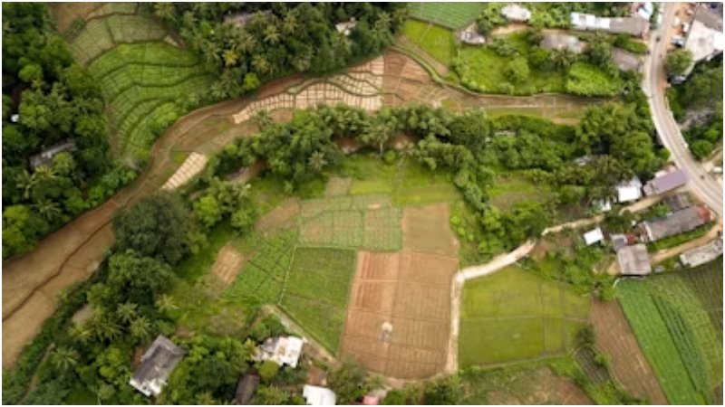
Successful land development begins well before final drawings, permits, or construction schedules. A dependable understanding of the property helps project teams make practical choices about building locations, access, grading, drainage, utilities, and protected areas. Early coordination with qualified survey, design, environmental, and on-site construction support professionals can also help translate plans into work that responds to actual field conditions.
Site data does not eliminate every challenge, but it provides owners, developers, planners, and community leaders with a stronger basis for decision-making. When a plan accounts for how water moves, where the ground changes elevation, which features must be protected, and what infrastructure already exists, the project is better positioned to avoid avoidable redesigns and long-term maintenance problems.
Why Site Data Matters Before Design Begins
A preliminary layout may seem efficient, but it can overlook critical site conditions such as steep slopes, easements, low areas that collect water, or existing utility lines. These factors influence the placement of buildings, driveways, and drainage facilities. Identifying these conditions early provides the design team with more options, while discovering them later can lead to compromises.
Relying solely on aerial photographs or old records is insufficient; current measurements and field observations are essential. Changes in vegetation, drainage routes, and visible site conditions may not align with older documents. A site visit can uncover issues like standing water, erosion, and access limitations that need to be addressed.
The Main Types of Site Information
Boundaries, Easements, and Existing Improvements
Accurate boundary information identifies the legal limits of a project area and helps locate easements, rights-of-way, adjoining uses, and potential access constraints. Mapping existing improvements is equally important. Buildings, pavement, retaining walls, storm drains, overhead lines, underground utilities, and wells can all influence a feasible layout.
Elevation, Slope, Soils, and Water
Topographic information illustrates changes in elevation and runoff paths. Soil and geological data provide insights into foundation conditions, erosion risks, and the suitability for water infiltration. Reviews related to water should identify streams, wetlands, areas prone to flooding, and any groundwater issues. Since requirements can vary by location, project teams must confirm the applicable local, state, and federal review processes.
Vegetation and Natural Features
Inventorying mature trees, wooded areas, invasive plants, and existing buffers creates an opportunity to incorporate useful features into the plan. Healthy vegetation and undisturbed soils can help slow runoff, stabilize slopes, and provide shade. Preserving the right areas may also reduce the amount of clearing, grading, and replacement landscaping needed later.
How Survey and Mapping Tools Improve Planning
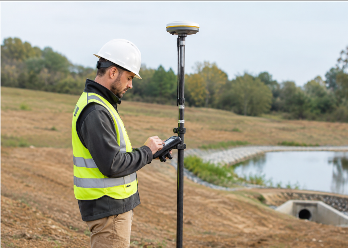
Field surveys provide a dependable base for design because they document measured conditions rather than assumptions. GPS equipment, digital elevation models, geographic information systems, aerial imagery, utility records, and environmental mapping can be layered to show how constraints overlap. For example, a map may reveal that the most convenient driveway location conflicts with a drainage route, utility corridor, or significant tree area.
Digital tools are valuable, but they do not replace professional judgment or field verification. A map can identify where more investigation is needed, while a site walk helps confirm whether the mapped condition is current, accessible, and relevant to the proposed work.
Stormwater Planning Starts With the Land
Roofs, roads, driveways, and parking areas shed water more quickly than vegetated ground. If runoff isn’t planned for initially, complex drainage solutions may be needed later. Starting with existing flow patterns helps protect downstream areas and safeguard structures.
Projects may employ swales, rain gardens, planted buffers, detention areas, permeable paving, tree planting, or infiltration practices based on site conditions and local requirements. A land-use and green infrastructure scorecard helps municipalities evaluate plans to protect water resources better and mitigate flooding.
There is no one-size-fits-all solution; factors like soil conditions, available space, groundwater, watershed characteristics, regulations, construction sequencing, and maintenance access all play a role. Difficult-to-inspect drainage features may fail over time.
Work With Natural Features Instead of Against Them
Natural features should be treated as design inputs, not simply as obstacles to be removed. Preserving a natural drainage path can reduce the need to redirect large volumes of water. Retaining trees and buffers may help limit erosion and provide shade. Following an existing slope, when appropriate, can reduce the extent of grading and help direct runoff away from buildings.
This approach does not mean that every feature must remain untouched. It means evaluating each feature’s function before making irreversible changes. A balanced design considers safety, site access, usable space, construction practicality, environmental constraints, and future upkeep together.
What Long-Term Research Shows About Green Stormwater Design
Performance should be evaluated after construction, not only during permitting. A 20-year USGS study of suburban development and stormwater management found that distributed stormwater practices were associated with lower runoff amounts and peak flows than a comparison approach centered on a few large facilities. The research also showed that water quality and ecological outcomes can be more complex, particularly where prior land use and new impervious surfaces affect conditions.
The practical lesson is clear: stormwater systems need inspection and care. Vegetation may need replacement; inlets and outlets may need clearing; sediment may need removal; and ownership responsibilities should be defined before construction is complete.
A Practical Site Review Process
- Gather records: Review available surveys, zoning information, utility plans, flood mapping, aerial imagery, and environmental records.
- Visit the property: Confirm visible conditions and identify issues not documented in existing records.
- Map constraints and opportunities: Identify slopes, drainage routes, trees, wetlands, easements, utilities, access points, and areas suitable for open space or lower-impact development.
- Test alternatives early: Compare multiple layout concepts before committing to a final direction.
- Coordinate review and maintenance: Confirm requirements with relevant agencies, then assign clear responsibility for future inspections and upkeep.
Common Mistakes That Create Delays
- Beginning detailed design before boundaries and easements are confirmed.
- Ignoring existing drainage until the buildings and pavement are already in place.
- Relying on outdated surveys without field verification.
- Removing mature trees before evaluating whether the layout can preserve them.
- Designing drainage features without safe access for inspection and maintenance.
- Failing to coordinate survey, environmental, civil, architectural, and construction information.
Conclusion
Better land development begins with better knowledge of the site. Accurate measurements, clear mapping, environmental review, early stormwater planning, and ongoing maintenance planning help create layouts that are safer, more practical, and more responsive to natural systems. Sustainability is strongest when it is built into the earliest site decisions, not treated as a final addition to the plan.